توزر

Border town on the fringes of the Sahara and Chott el Djerid
Tozeur is one of the desert fringe cities that ring the northern edge of the Grand Erg Oriental, and is on the edge of the giant endorheic lake Chott el Djerid. The city dates back to Roman times, and is built around a large oasis with date farming being one of the largest parts of the economy. It is also very near to the Algerian border, so I didn’t wander too far out of town.
I figured Tozeur would be a good point to finish off my trip into deepest desert Tunisia, so I crossed the Chott el Djerid salt lake from Douz by louage, changing at Kebili on the way. I spent an afternoon and a night in town, then it was about 9 hours by train straight back into Tunis the following day. My lodgings were whatever was cheap and convenient upon my arrival, unfortunately I don’t remember the name. There were several large tourist hotels at the west side of town, but my time was short and I wouldn’t have got the value out of them.
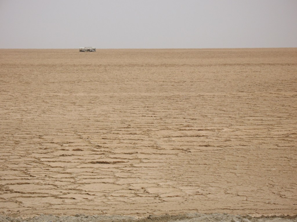
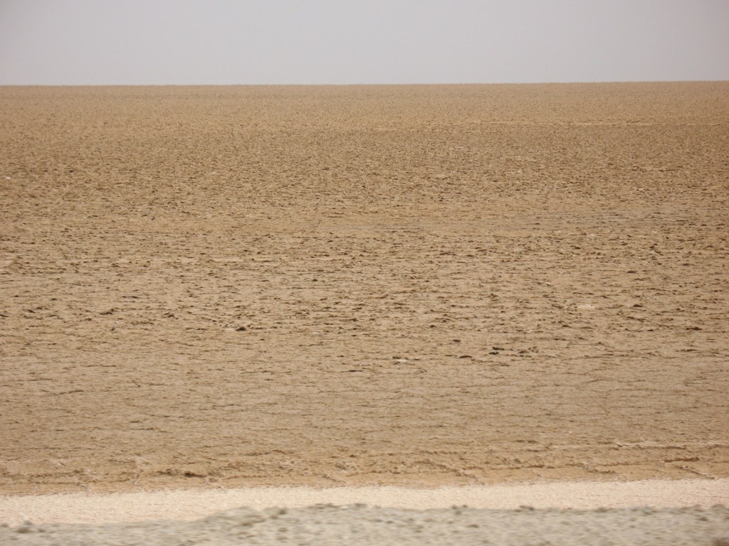
Chott el Djerid is a large salt flat which occupies a sizeable portion of southern Tunisia. It is usually devoid of water except in winter, and today was no exception, but had there been a flash flood we would have been protected by the road being on top of an embankment.
While not quite the Bolivian salt flats of Uyuni, some of the salt is still visible on the lake bed, and, as you’d expect, there’s the skeleton of a bus in the background. Perhaps they took a wrong turn.

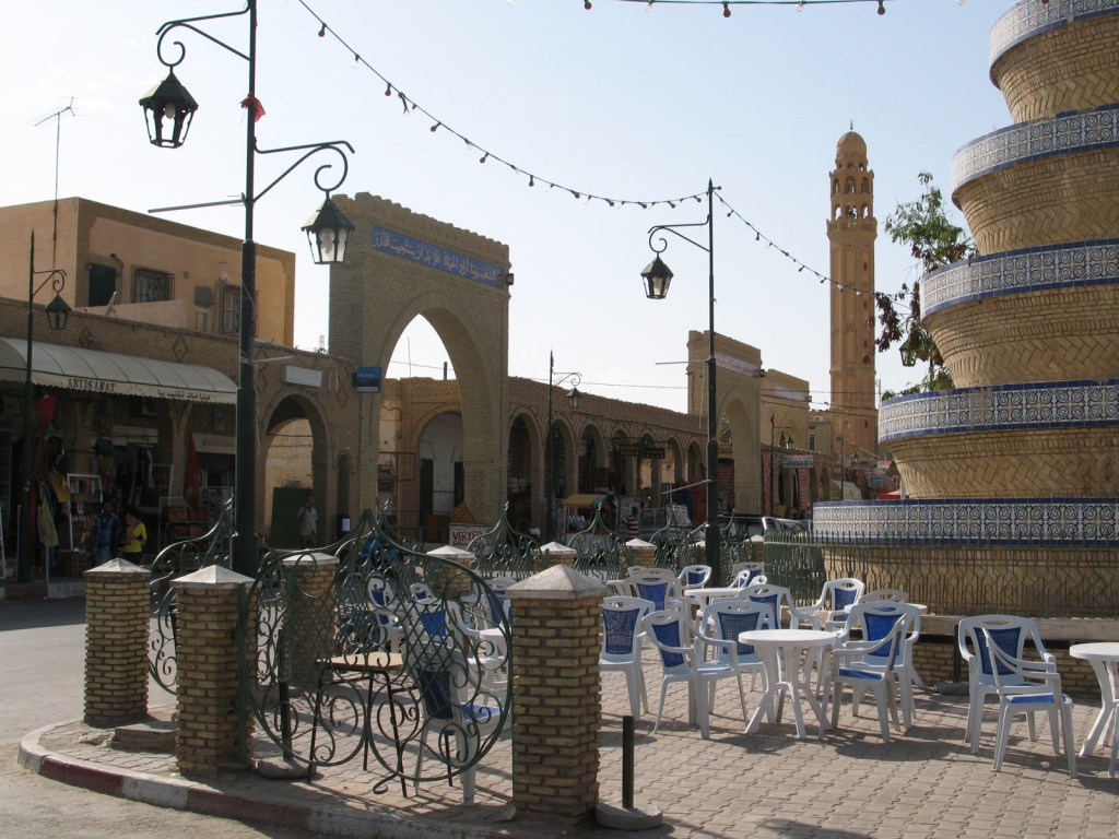
The centre of Tozeur hosts a small market and fountains at the edge of the medina.
Tozeur is well known for its brickwork architecture, used as a form of low-resolution pixelated patterns throughout the medina.
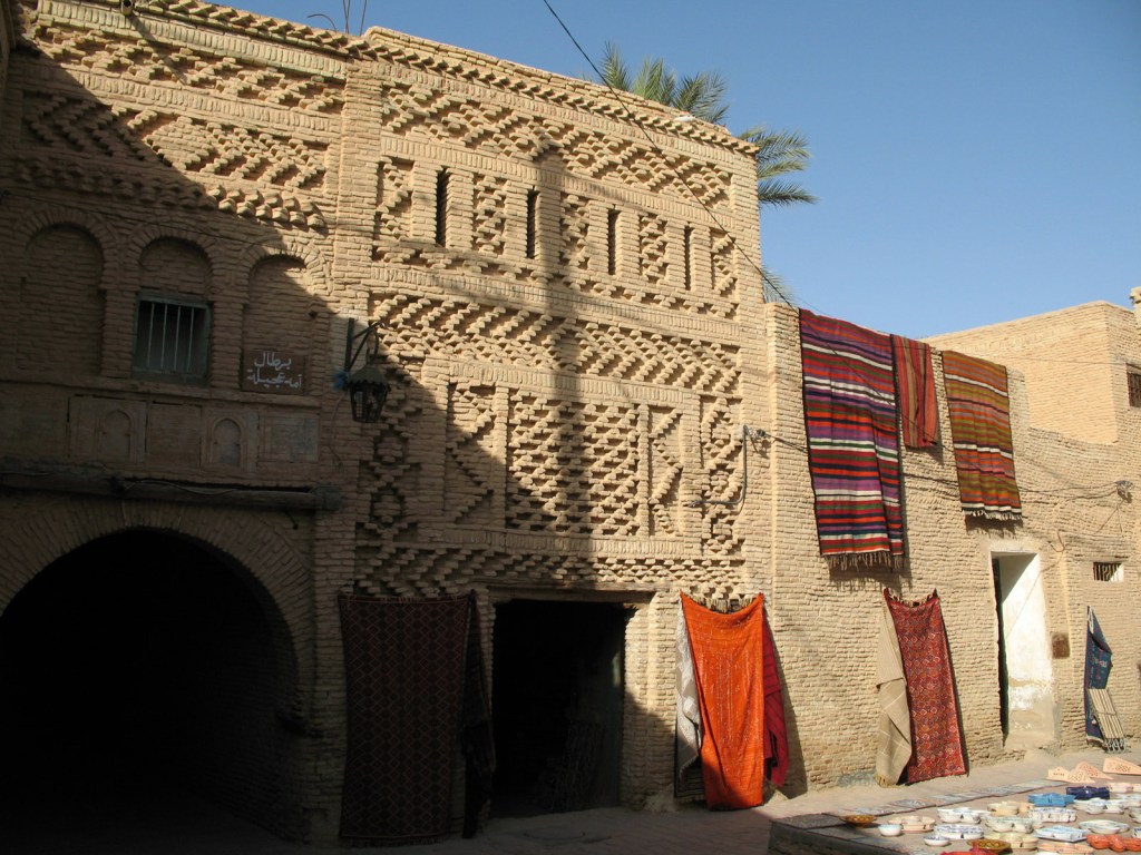

Further fancy brickwork examples in the medina of Tozeur, which was monumentally confusing to navigate.
I eventually found my way out of the medina maze, back into the central market place. This is the local Avenue Habib Bourguiba.
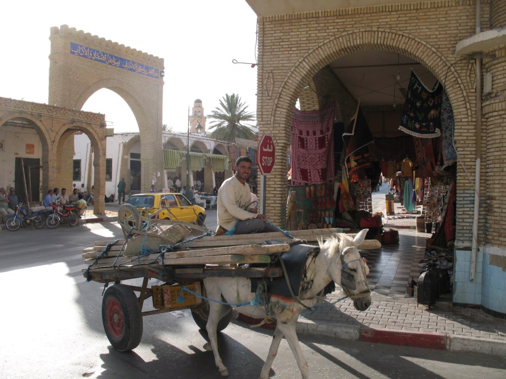
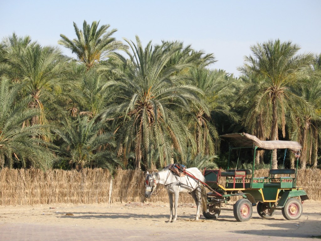
Tozeur had plenty of traditional elements, like horses and carts, going around.
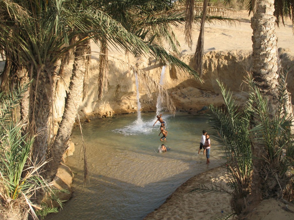
I took a wander to the west of town, to check out the music park. On the way there were some folk having fun at the Ras El Ain spring, source of most of the scarce water the town has.
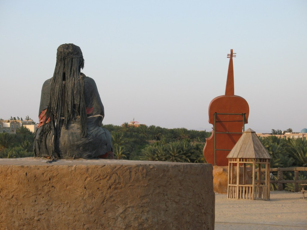
Tozeur’s Ras Al Ain music park was another strange place, although it kept to its theme with giant model violins and a large brooding matriarch (?)
They’ve even got their own version of Mount Rushmore here – featuring the repeated face on all four sides of perhaps Tunisia‘s most famous poet, Aboul-Qacem Echebbi.
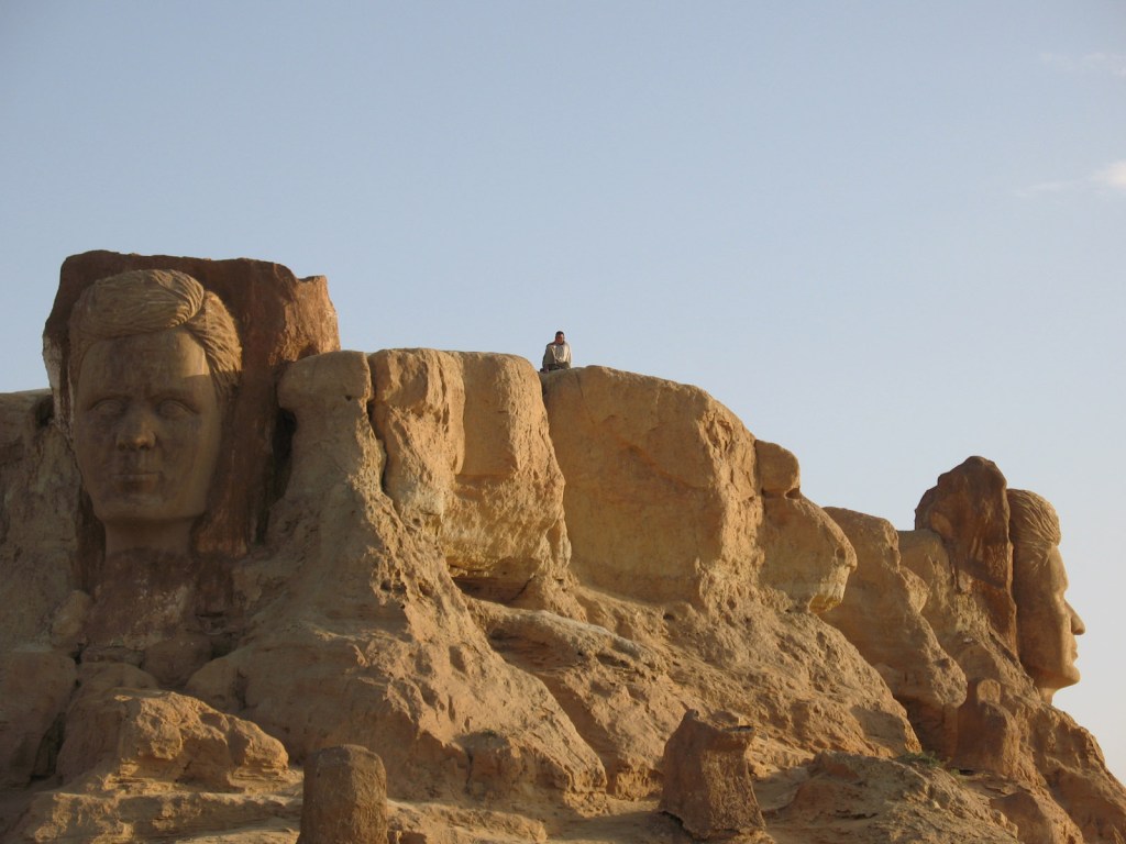
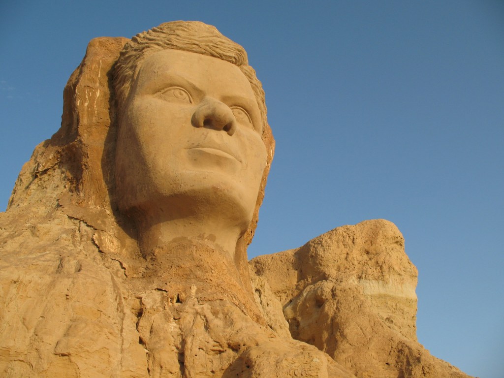
The faces give the place a bizarre feel, but they’re very well done and blend in with the rock nicely. They are in fact made of fibreglass. Echebbi is well known for completing the current version of Tunisia’s national anthem. He only lived to twenty-five, and his mausoleum is nearby.
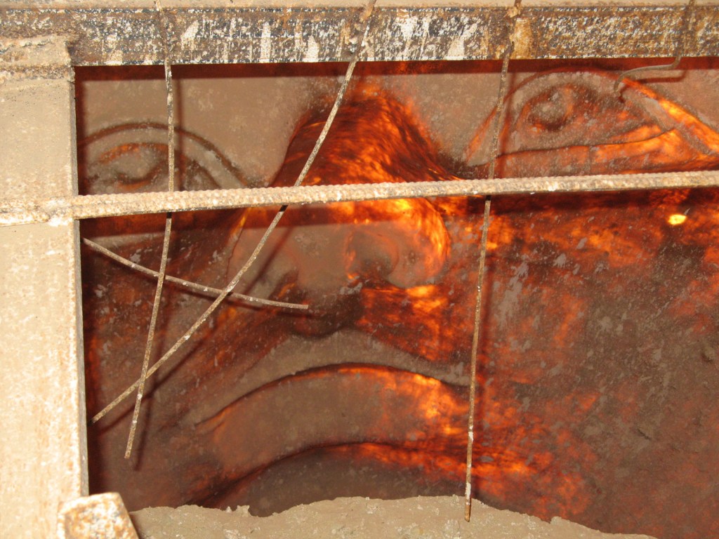
One of the Echebbis had a hole in the back of his head, so it was possible to have a glimpse inside, from which he more closely resembles an Olmec colossal head of Mexico.
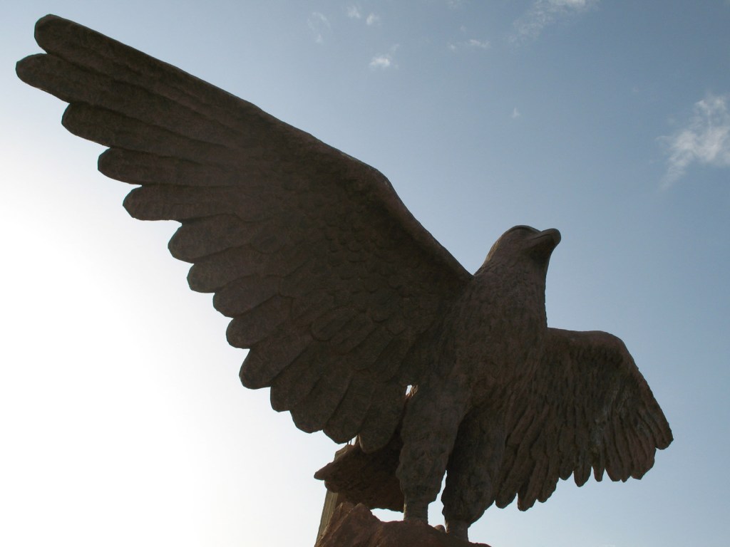
There was also a quite impressive eagle statue, and a few real camels wandering around.
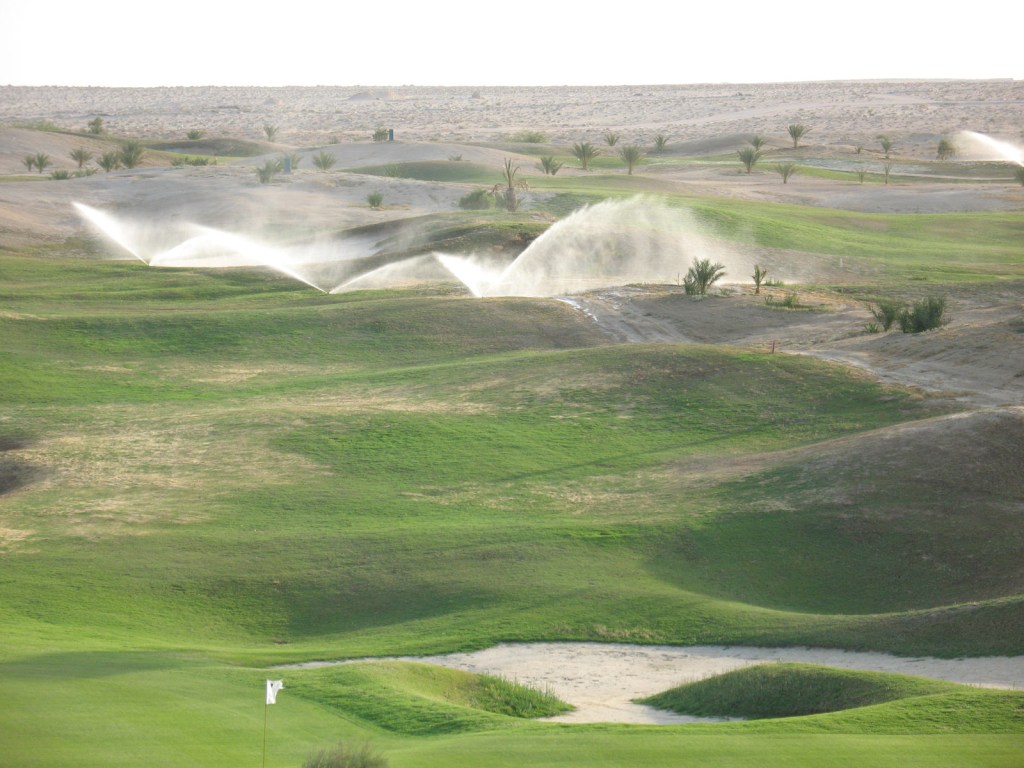
Standing atop Mount Echebbi, I could see the hard work going on to expand Tozeur’s golf course out into the Sahara. My 2023 research revealed that the golf course died a death somewhere between 2013 and 2016, and quickly returned to its native sandy state.
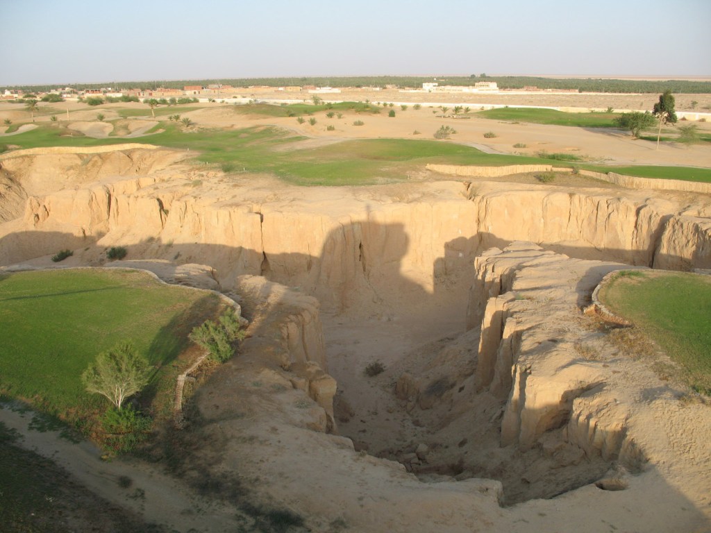
A small but well proportioned canyon runs through the golf course. The nearby but much larger Sidi Bouhlel Canyon was the filming location for Indiana Jones: Raiders of the Lost Ark, and of course, more Star Wars.
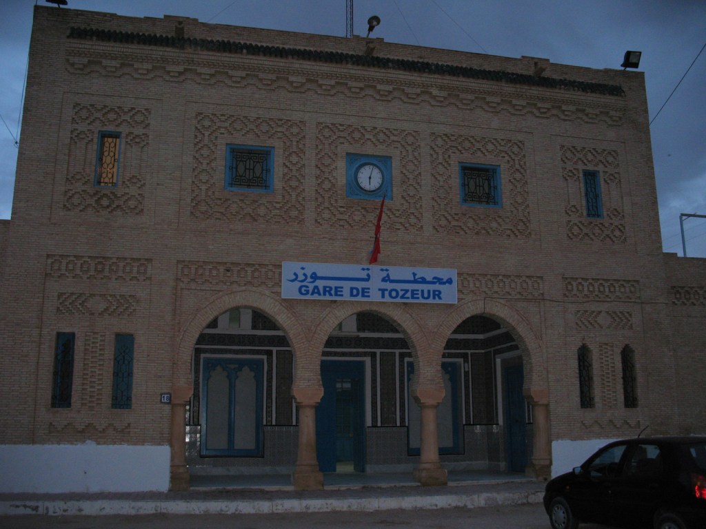
The following morning at 6 AM it was time to head back to Tunis and beyond to Sidi Bou Said, on the only train that day from the Gare de Tozeur, also done in the distinctive Tozeur brickwork style.
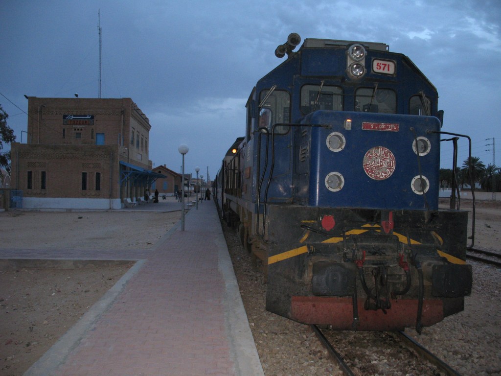
The train looked worryingly rustic from the outside, but was in fact quite comfy inside once we got going.
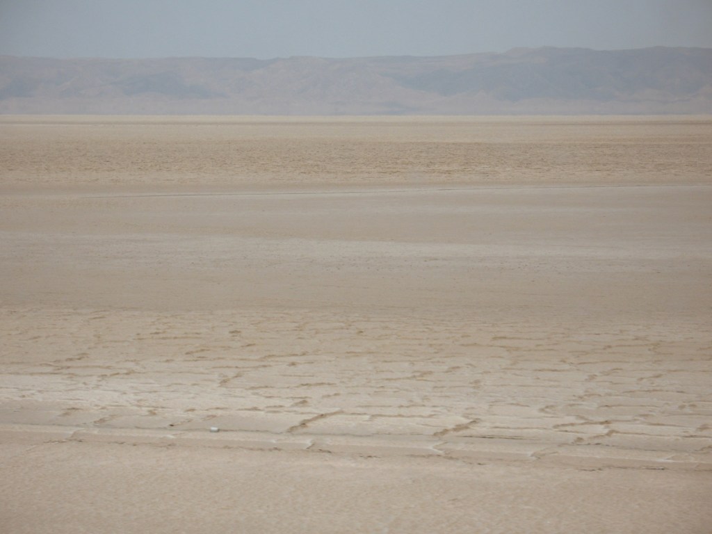
The train skirts the edge of Chott el Djerid again: this alien landscape was also used in Star Wars, with an additional moon superimposed above it. There have been plans drawn up to cut a canal directly to the Mediterranean which would permanently flood the area as it lies up to (down to?) twenty-five metres below sea level.
Created 2008 | Updated 2023

Leave a comment