
City of lakes and industry on the mighty Mississippi River

The largest city in Minnesota, Minneapolis together with the nearby state capital Saint Paul, forms the twin cities urban area on the upper Mississippi River. Minnesota has a strong Scandinavian influence with many immigrants from Norway and Sweden, perhaps because of the similar climate – the winters can be incredibly cold. There is also a quite distinctive accent in the state, which even to my untrained ear sounds closer to Canadian than American.
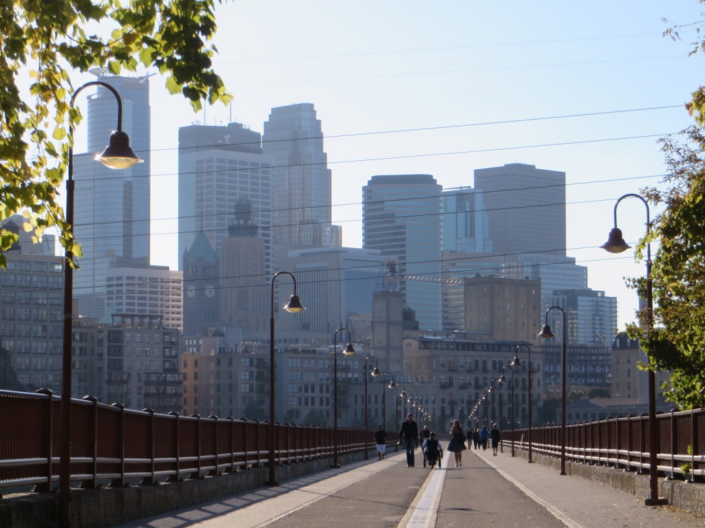
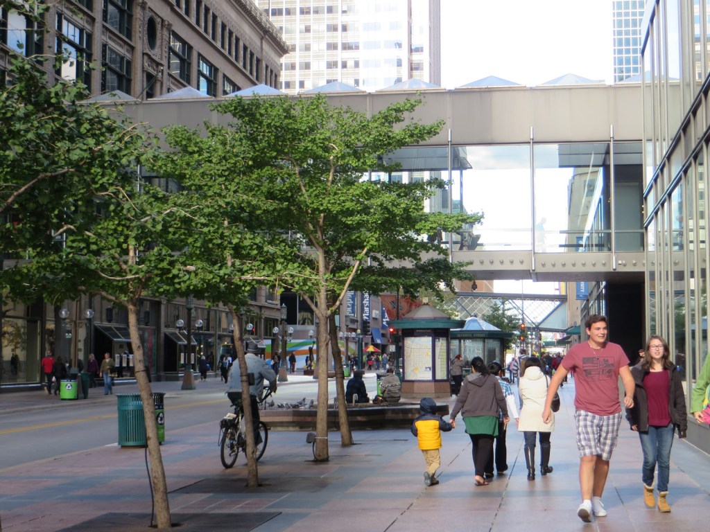
I transited through Minneapolis several times on my way to and from Alaska, but only had time on one occasion to actually get out into the city between flights. I had a full afternoon in beautiful October weather to explore the downtown area and cross the river, having come in on the very efficient light rail system from MSP airport.

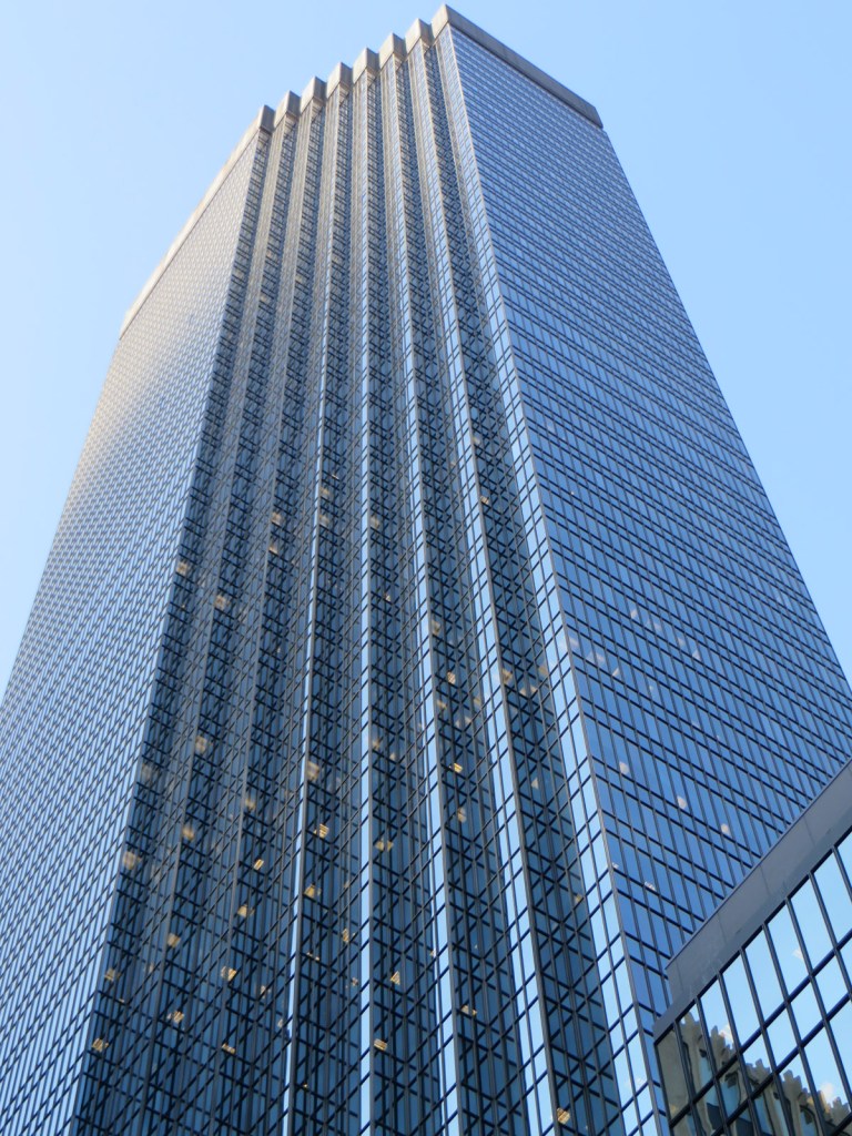
Postmodern downtown Minneapolis, with the Capella Tower peeking from between the Wells Fargo Center and IDS Center.
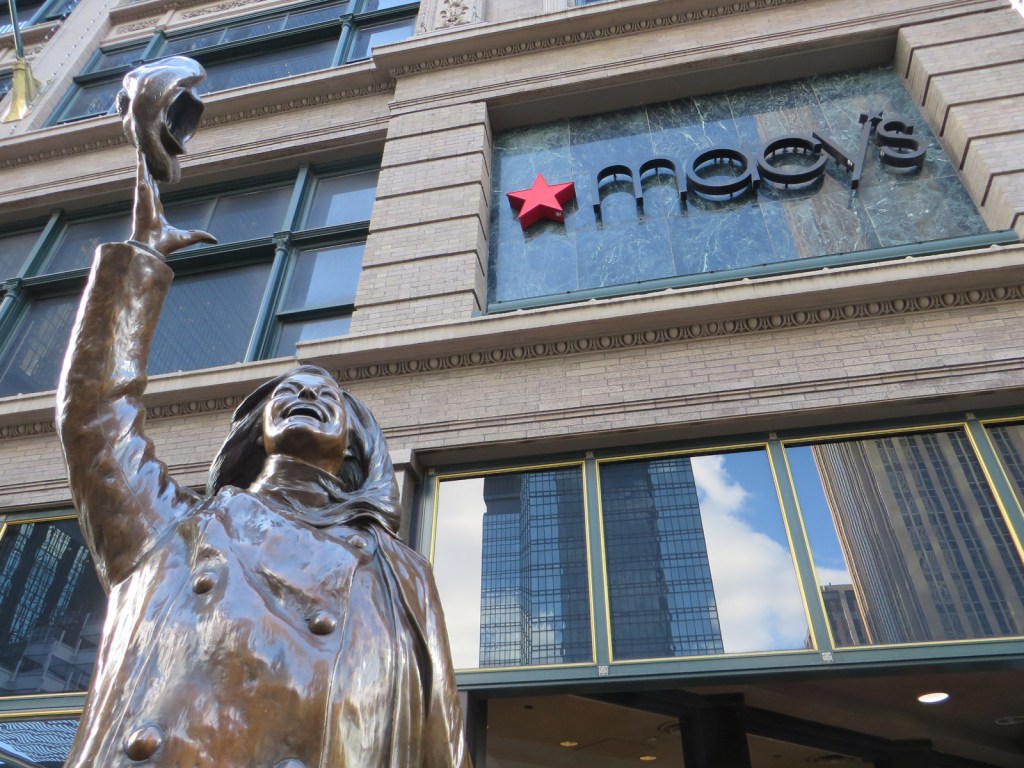
Mary Tyler Moore throws her hat in the air outside Macy’s, in character as Mary Richards. Although Moore herself was from New York, the Mary Tyler Moore show was set in Minneapolis, with the statue dedicated in 2002.
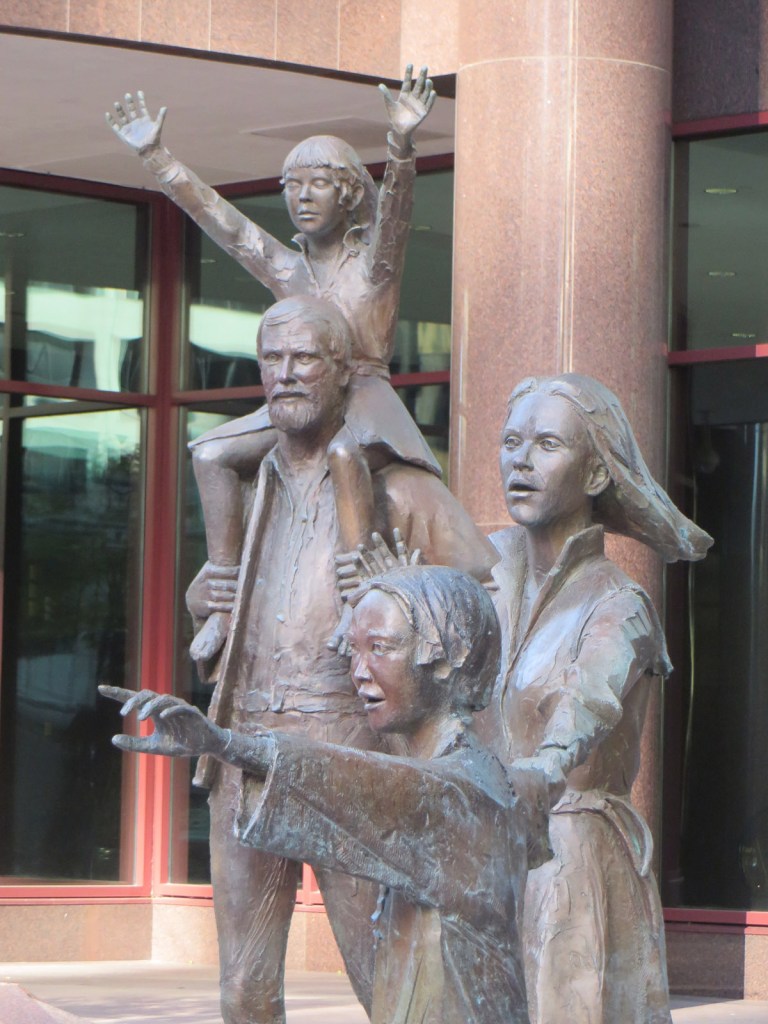
Another bronze rendition (but not star-struck fans of Mary Tyler Moore), this statue Family was located outside the Fifth Street Towers until being moved to the Minnesota Landscape Arboretum some years after my visit.
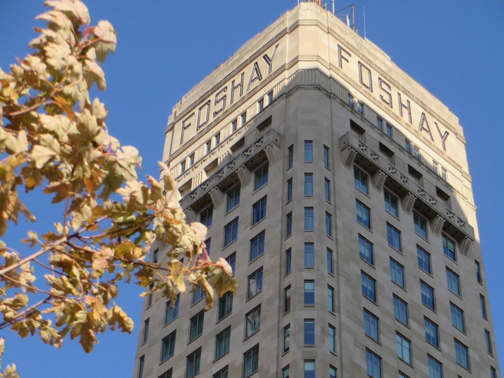
Foshay Tower was for many years the tallest in the city, having been built in 1929 at the peak of the art deco movement. Modelled loosely on the Washington Monument it is now a W Hotel, and includes a handy public viewing gallery at the top. Which I visited, of course.
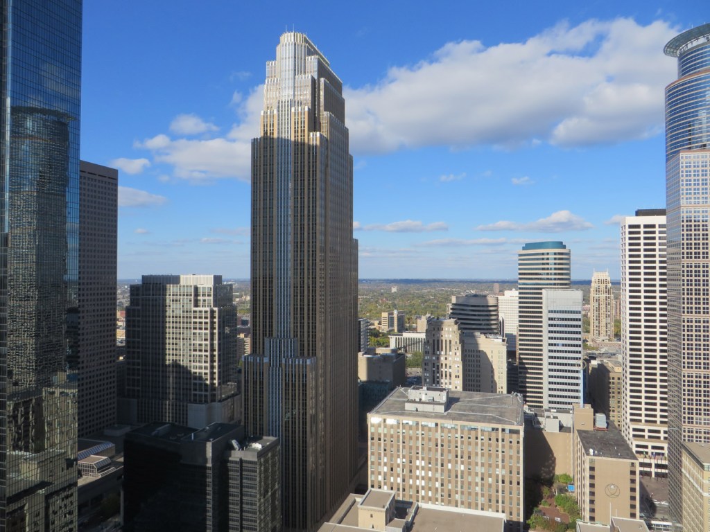
View from the top of Foshay Tower to the north across downtown. On the left is IDS Center, Wells Fargo Center is in the middle, and Capella Tower is on the right. All three vied for the title of tallest in Minnesota, until IDS built a window washing shed on its roof to reclaim the glory.
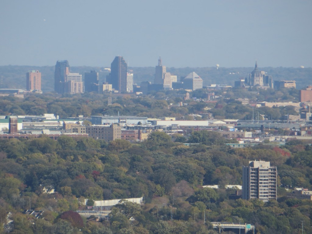
Looking across to Saint Paul in the east, the state capital city is smaller than Minnesota but the two have long since merged into one large urban area.
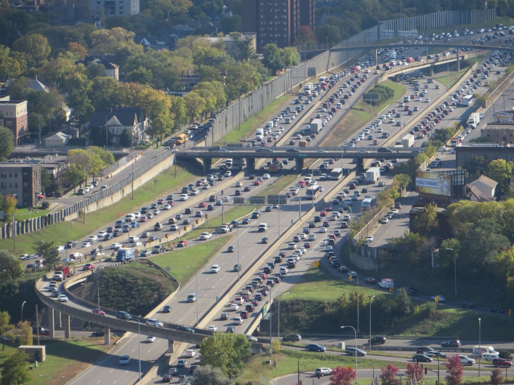
Friday evening traffic chugs along Interstate 35 – the next major stop to the south is Des Moines, Iowa, then it’s on to Kansas City.
With its dreadfully cold winters, Minneapolis has opted to connect together its downtown blocks. But while Montreal and Toronto have their underground cities, the Minneapolis Skyway links dozens of buildings with nearly ten miles of overhead walkways, so people can generally avoid leaving heated comfort in the city centre.

The Crystal Court at the base of IDS Center is a nexus of the Skyway system, being the first block to connect to all four of its neighbours.
IDS Center while unfortunately named like a gastric problem, is the tallest building in the state at 241 metres including the window cleaning shed on the roof. Crenulations on all sides ensure maximum corner office space.

Minneapolis City Hall is a very pleasing design and was completed in 1909. The copper roof has turned green in the same manner as the Statue of Liberty.
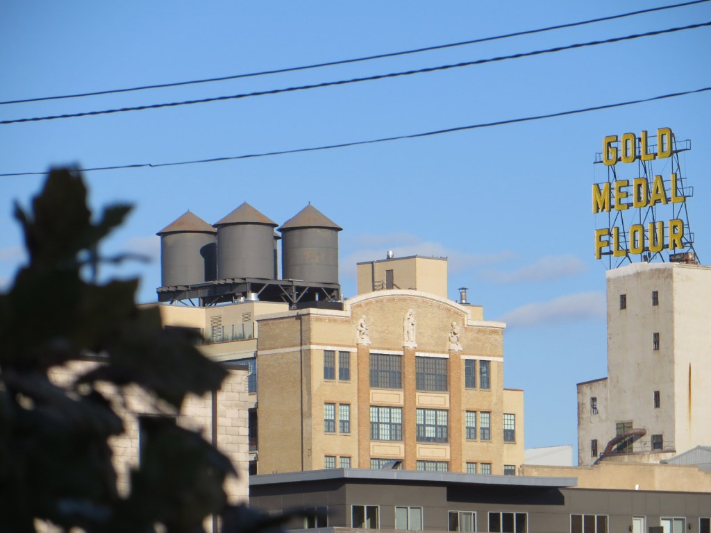
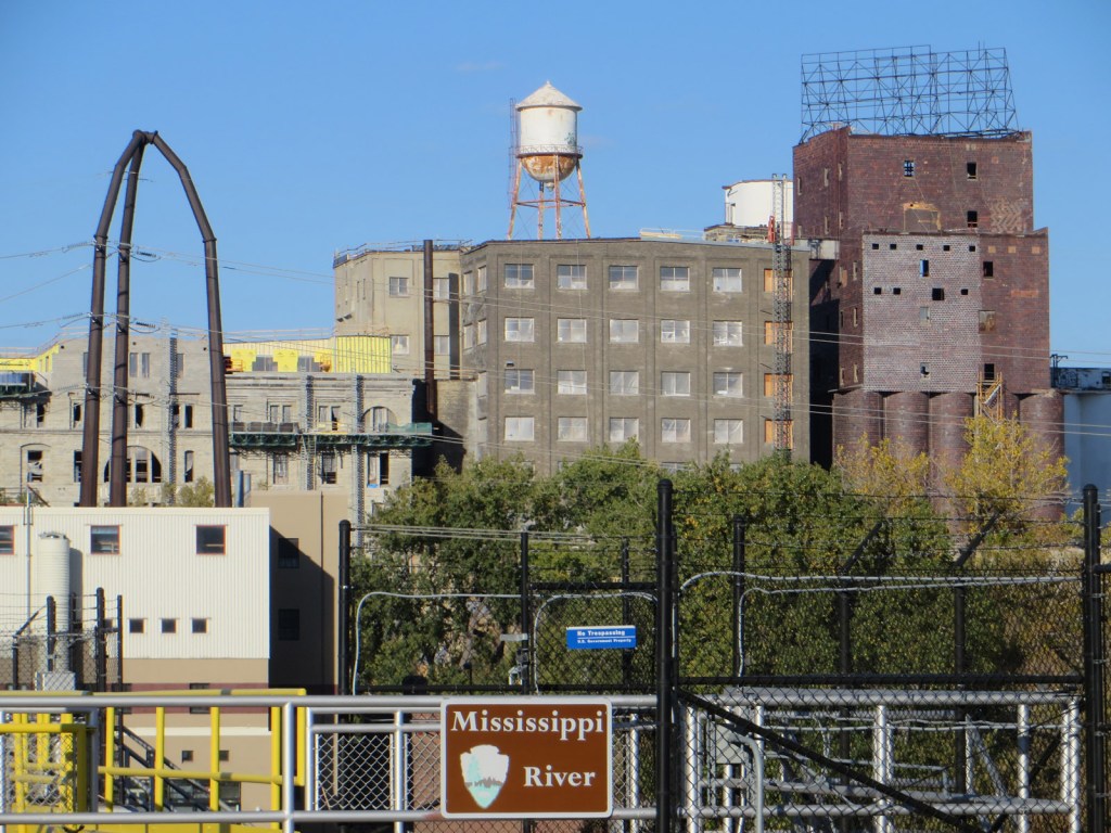
Gold Medal Flour was one of several companies that milled their produce on the river bank from the late 1800s until the 1960s, using the near-infinite hydro power of the Mississippi.
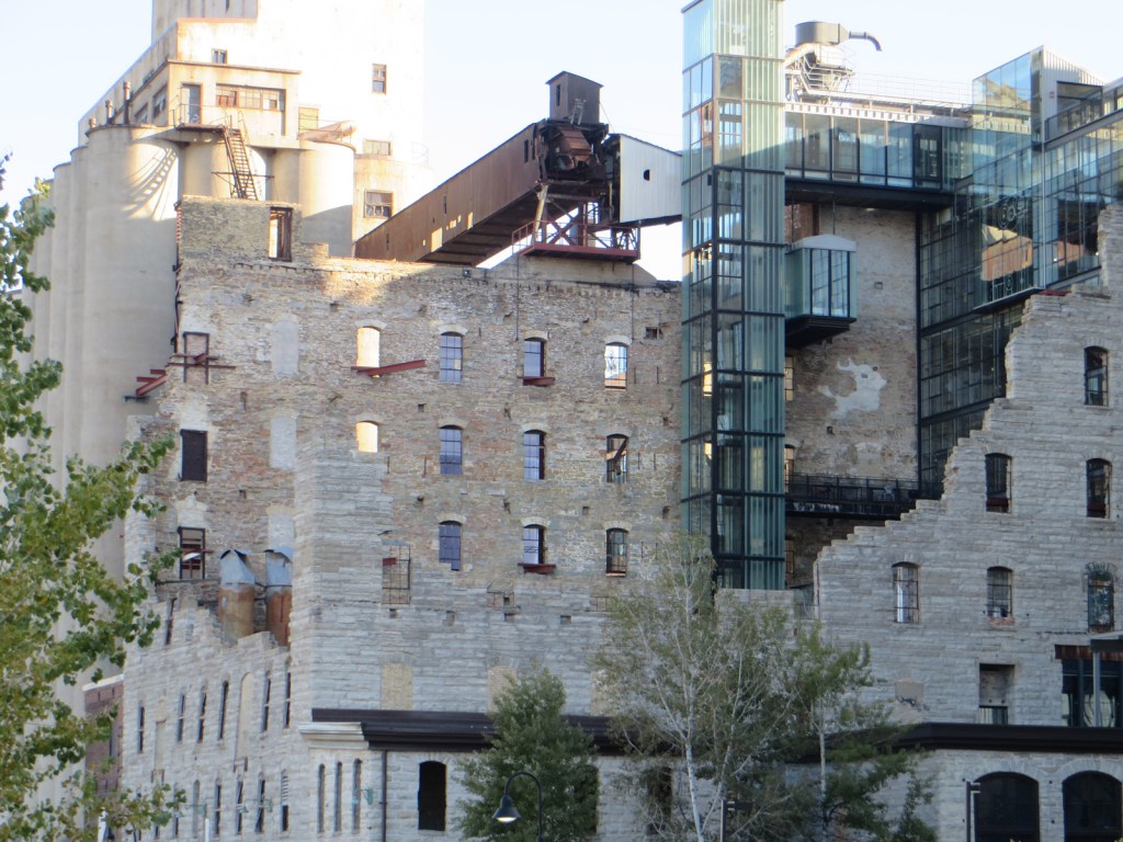
The old mills complex has now been converted into a heritage museum, primarily built into the ruins of the Washburn “A” Mill. For about fifty years from 1880, Minneapolis was known as the flour milling capital of the world.
Mill City Museum and the Mill Ruins Park in the foreground have been established inside the remains of around twenty mills.
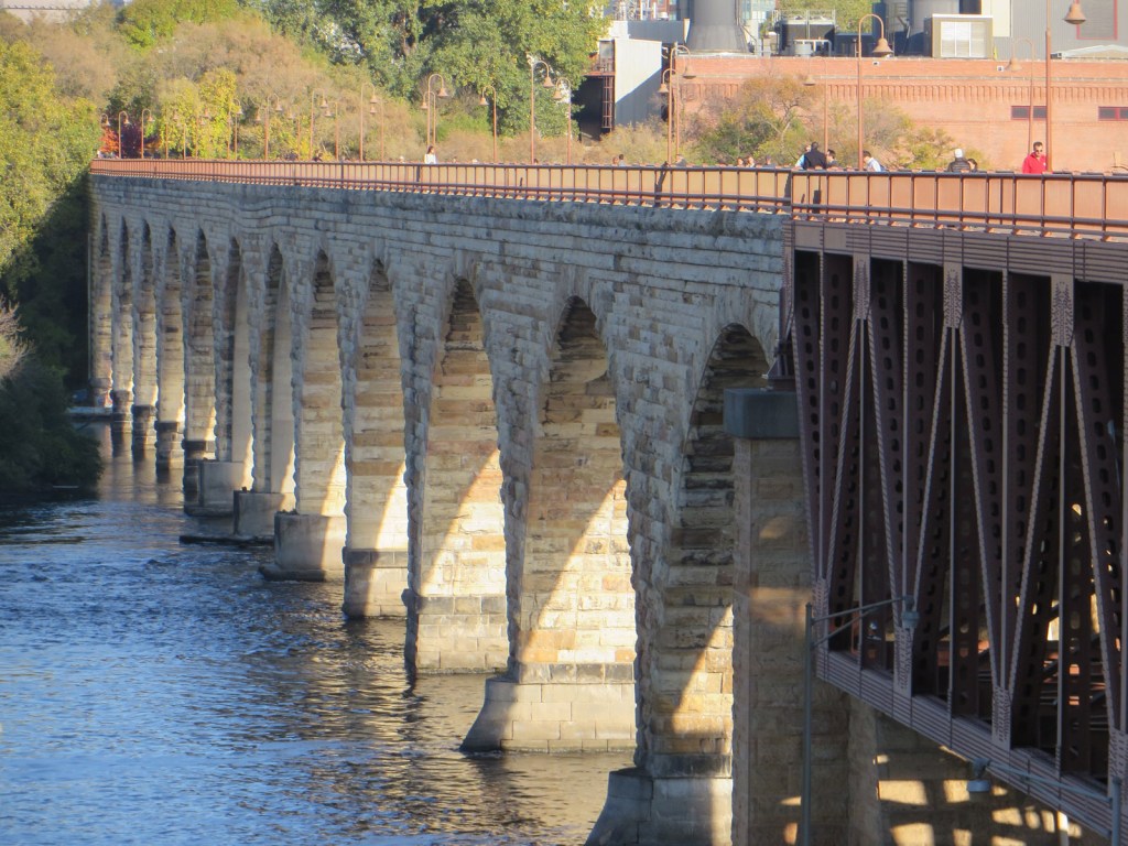
Stone Arch Bridge crosses the Mississippi from Mill City Museum. It was completed in 1883 for the Great Northern Railway, but now carried pedestrians and cyclists.
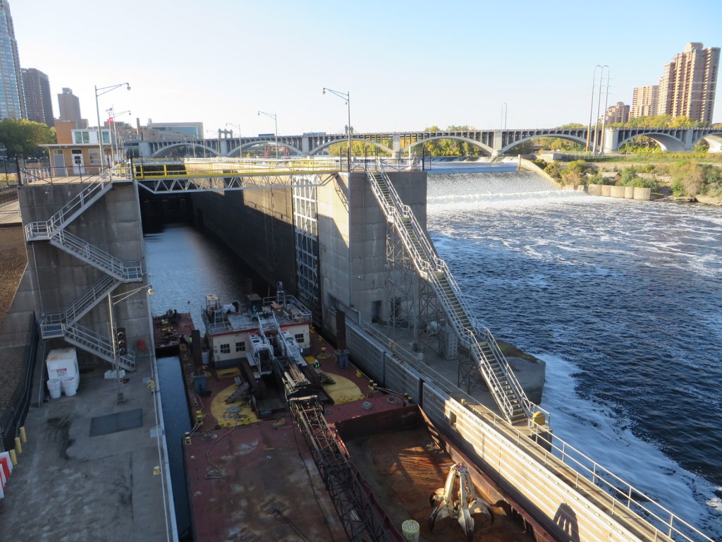
Saint Anthony Falls is the only major natural waterfall on the river, although since raised artificially for hydropower. There are two sets of locks to allow vessels to navigate further upriver.
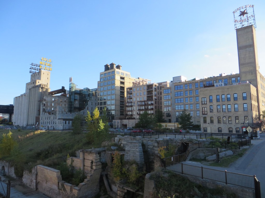
It wasn’t all museums and gentrification when I visited in 2014, the Pillsbury Flour Mill still stood empty, but has since had its giant sign restored, and been converted into posh loft apartments.
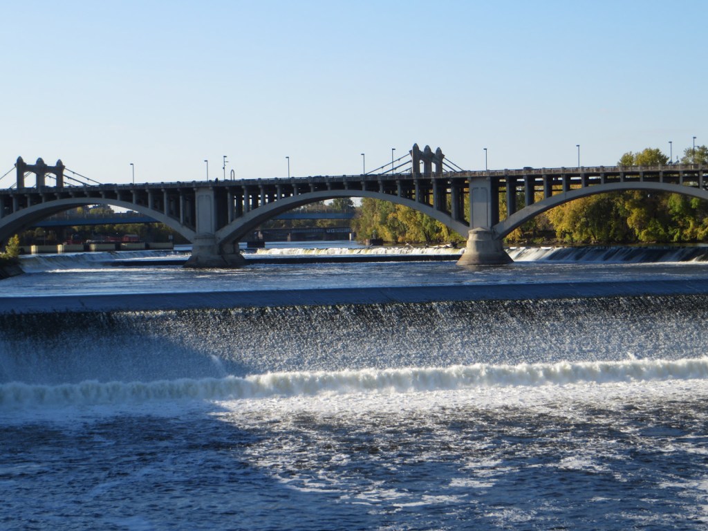
Crossing Stone Arch Bridge I had a great view of St Anthony Falls, with the Third Avenue Bridge behind. There is a pronounced hydraulic jump at the bottom of the concrete apron, to reduce erosion.
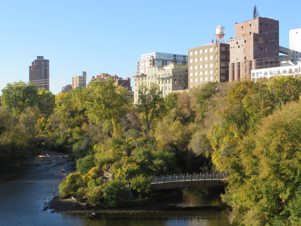
View of the north side of the river and Father Hennepin Bluff Park from Stone Arch Bridge.
I spotted this listing stone remnant in the middle of the river. As far as I can determine, it was the corner of a stepped weir that I believe still exists under the water, which was raised by the Lower Saint Anthony Falls Dam in 1897.

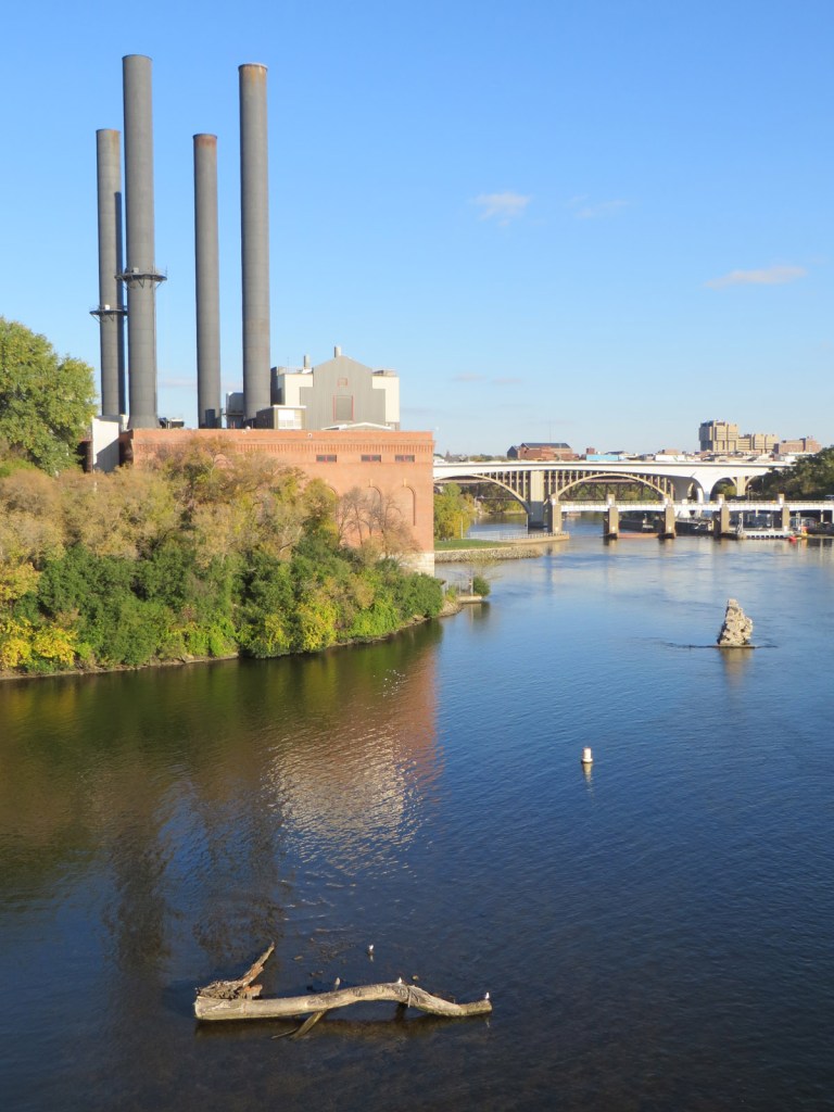
Stone remnant again visible, next to the four chimneys of the University of Minnesota Southeast Steamplant. The plant provides heat and power to most of the university campus, having been purchased from the city in 1976, but was originally built in 1903.
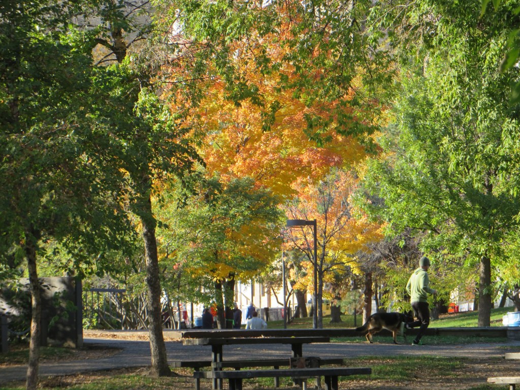
The beautiful colours of autumn or fall (depending on which side of the Atlantic you hail from) were coming through. Having just come from Anchorage where winter was already taking hold, it was nice to experience it again!
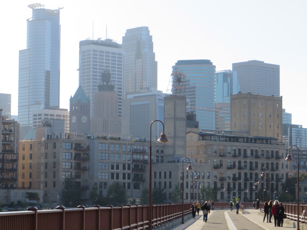
Downtown Minneapolis as seen when I crossed back over Stone Arch Bridge.
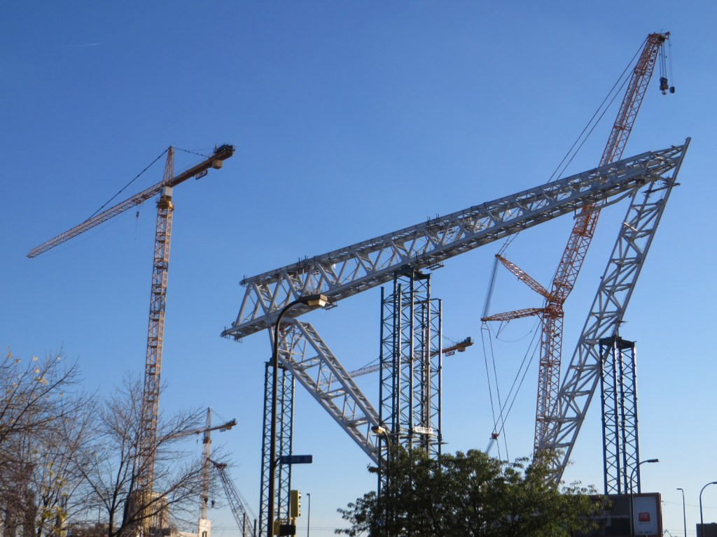
By the light rail track, a new stadium was beginning to take shape on the site of the old inflatable Metrodome. The US Bank Stadium is now the home of the Minnesota Vikings NFL team (note the Scandinavian connection), and opened in 2016.
Created 2023

Leave a comment