

The Grand Canyon State, classic US desert landscape with a few surprises too

Arizona is the newest of the contiguous states, having been created in 1912, after which remained only Alaska and Hawaii. The perception of the state is generally of desert, cactus and gunslingers, but there is a great diversity across the land. Arizona has some of the most spectacular natural scenery in the US, if not the world, including its centrepiece the Grand Canyon.
I visited Arizona in April 2004, when I went to see some of the friends I had lived with in Valencia for the previous academic year. I was based in Flagstaff for a week and made day trips from there to Monument Valley, Sedona and the Grand Canyon amongst others. I also had a brief visit to Phoenix, and I flew home from Los Angeles after catching an overnight train.
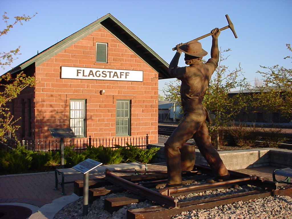
Flagstaff station and a memorialised railroad worker – as well as the Santa Fe railroad, Flagstaff sits on historic Route 66. It is the nearest sizeable city to the Grand Canyon, seventy miles away, and is the third city in Arizona.
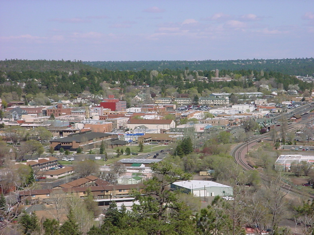
The town of Flagstaff from up near the Lowell Observatory, from which Pluto was discovered in the 1930s. Flagstaff’s elevation of about seven thousand feet means that it is a good clear place for astronomy, and the thin air also means you can get drunk more easily.
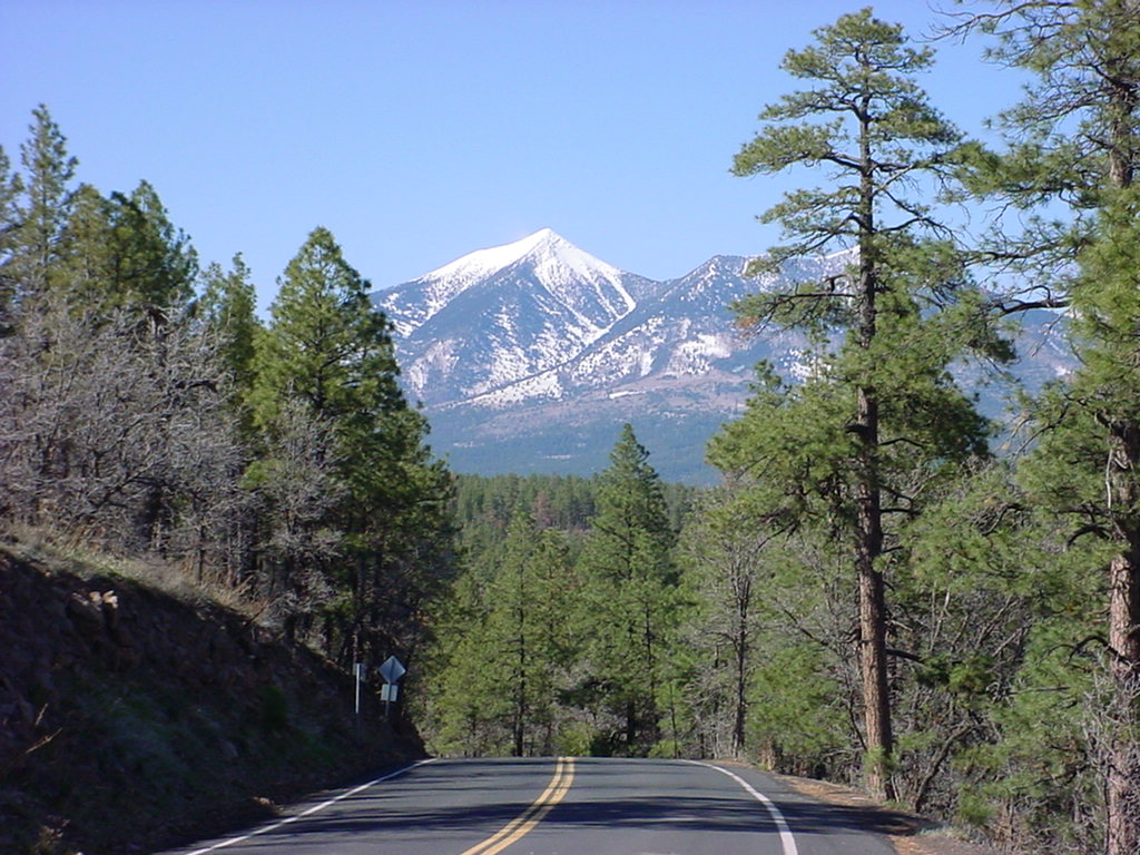
The San Francisco peaks form a spectacular backdrop to Flagstaff, Humphrey’s Peak in the centre is the highest point in Arizona at 12,633 feet. The Arizona snowbowl is a popular ski resort with varying snow reliability, which has led to the proposal of more snow making facilities on the mountain. However the area is also sacred land to thirteen Native American tribes who have already had to put up with the destruction of their forests for the ski industry, and don’t want any more.
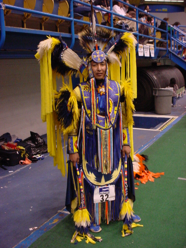
We visited the Pow-Wow at Northern Arizona University’s Skydome arena, where there were two days of Native American chanting and dancing. This chap is dressed for the fancy dance contest, in full regalia, and was happy for me to take his photo and to tell his story.

My first glimpse of the Grand Canyon through the trees as we marched up to the edge ready for our descent. The canyon is never less than four times as wide as it is deep, so I’m told, which means that at the depth here of one mile (!) the opposite rim is four miles away.
After we had hiked down the Kaibab trail about halfway to the Colorado River, Pat had a little snooze while I took some photos. There are warnings at the start of the trail telling you not to try to hike to the river and back in one day as you will probably die, but nonetheless we met some keen German and Swiss people who were on their way back up having just been right down to the water’s edge, and they were still in good spirits.

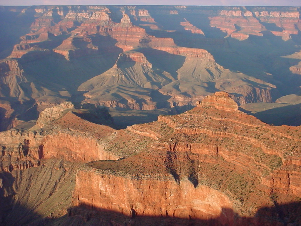
View from the south rim, as the sun went down all the colours changed and the quietness was very pleasant. The hike was not quite what I was used to, as normally I start with a lot of “up” before a significant amount of “down” rather than the other way round. It’s this which catches people out, they think they’re doing fine all the way down but when they start the five-thousand foot ascent they get into trouble.
Slide Rock State Park to the south of Flagstaff, not unlike Linn of Dee near Braemar by design. People were jumping off cliffs into the freezing cold water, and sliding down the natural chutes in the rocks which the river has carved. We also had a short hike upstream through the gorge.

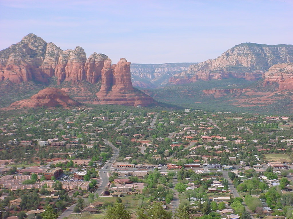
Sedona, yet further south of Flagstaff towards Phoenix is a very scenic tourist town which due to its strict building planning laws and colour harmonising, boasts the worlds only McDonald’s with blue arches not golden. This is the money shot from near the airport.
I had heard of the ghost towns of Arizona, so was keen to visit Jerome on the way back from Sedona. A former copper-mining settlement, it is still populated by a few hundred people so not strictly abandoned, and is becoming a bit gentrified. The red roof of the civic building is prominently visible.


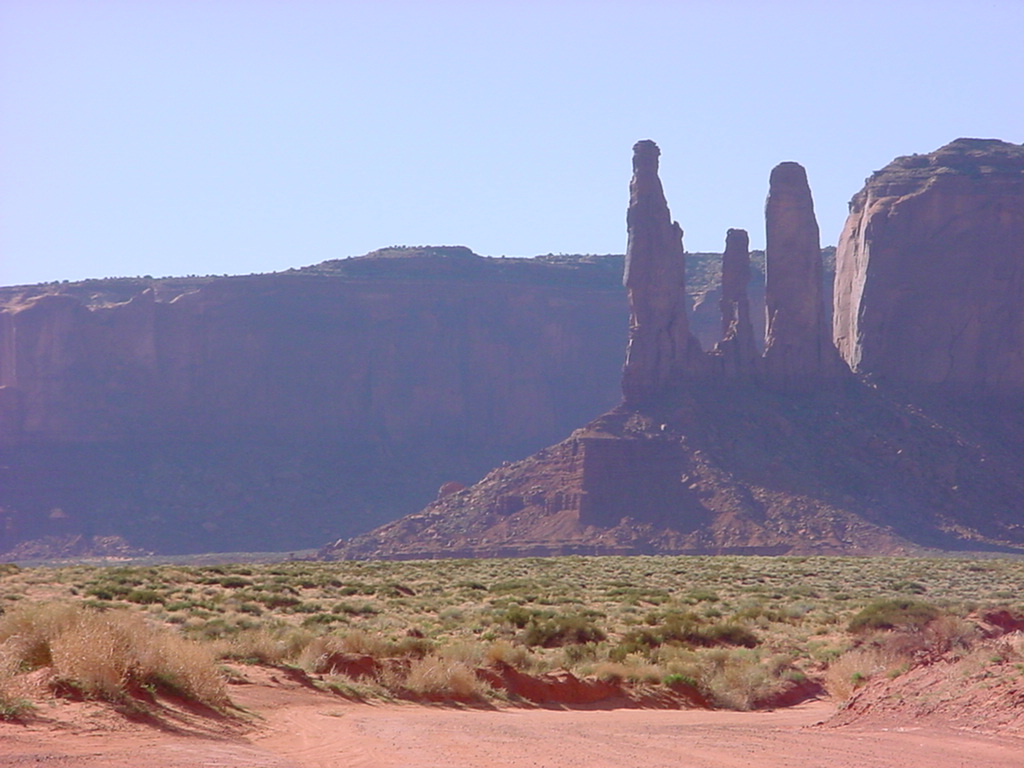
I briefly crossed into Utah, on my trip up to Monument Valley. My journey took me through Navajo land where all I could pick up on the radio was the atmospheric chanting of Navajo FM. These are the places where there are no people for miles around, the tumbleweed blows through, and the vultures circle above.
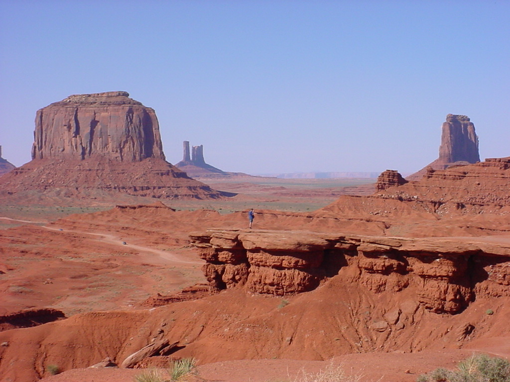
Monument Valley is famous for these rock formations known as the “Mittens” which were formed by lengthy erosion processes. They are sacred to the Navajo, and as such rock climbing is not usually permitted. The area spans the Arizona/Utah border and there is a dirt track which you can drive around to see the best views. The west mitten is around 260 metres and the east mitten around 310 metres tall, and would eclipse any skyscraper in Los Angeles.

These three rock spires are known as The Three Sisters, and were tricky to photograph in the late afternoon with the low sun.
John Ford Point, named after the director who shot much of his famous work for the old Hollywood westerns here. More recently, some scenes from “Back to the Future III” were filmed here.

The Totem Pole is the tallest and most slender spike of rock, famous in the world of rock climbing. It is eight metres wide and over one hundred metres tall.
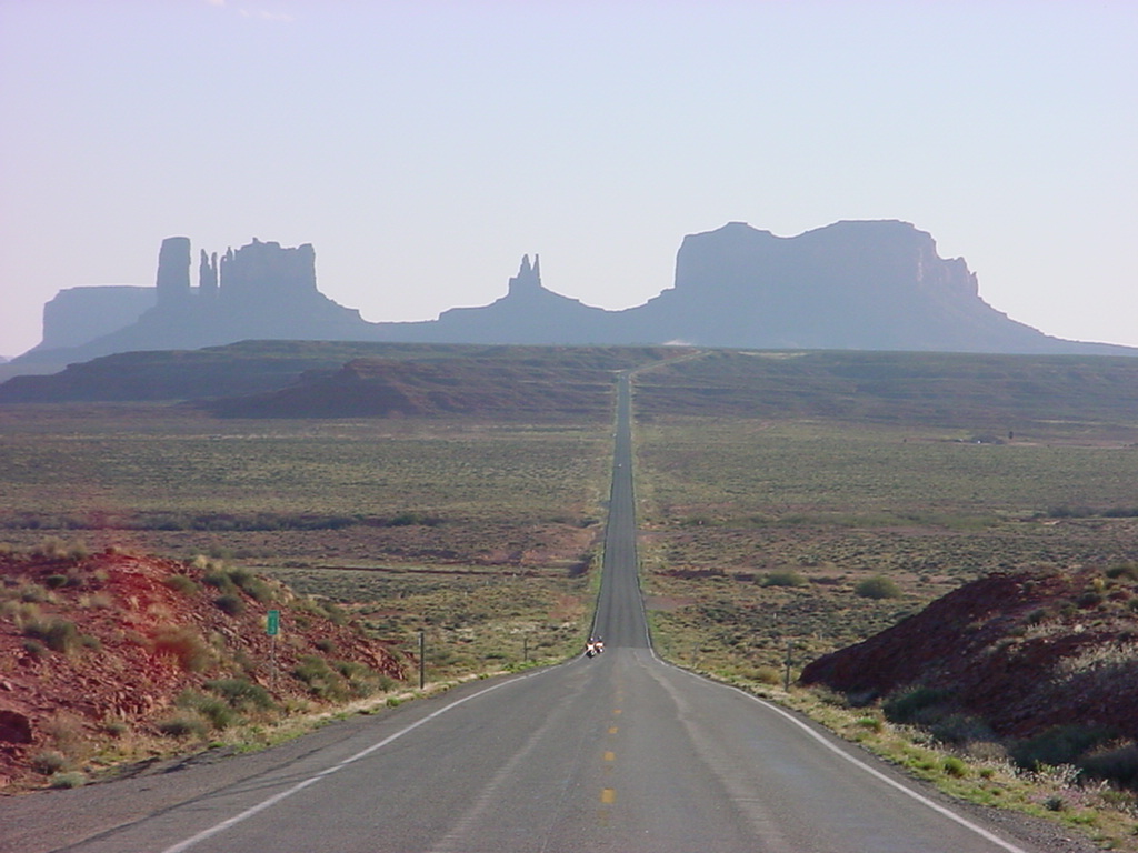
This classic western view was on a postcard in the visitor’s centre, which I gave to the person at the till and asked “how do I get there?” So I was pointed further up the road into Utah to this archetypal American open road, the essence of Easy Rider and the Eagles. I had always assumed that this was Route 66 but it is in fact Route 163, looking south back towards Arizona around twenty miles away. I kept checking over my shoulder to make sure I wouldn’t get flattened by the next truck, mid-photo.
Created 2004 | Updated 2018, 2023

Leave a comment