सगरमाथा

World Heritage Site and home of Mount Everest
Sagarmatha National Park is named for its highest peak – Sagarmatha in Nepali, perhaps better known as Mount Everest in English. Adventurers approaching the base camp from Nepal do so by trekking through the Khumbu valley from Lukla over a period of around nine days, stopping to acclimatise along the way at villages such as Namche Bazaar and Dingboche. The trek back is much faster, being only around four days as you descend back into thicker atmosphere. The park was declared a World Heritage Site in 1979.
As high and remote as the park is, I found it to be remarkably well resourced and a comfortable as well as spectacular experience to trek through, although we only reached the approximate tree line at around 4,000 metres elevation in Khumjung. Our tour “Everest Express” was designed for such busy folks as ourselves, giving a taster of the Himalayas and taking us as far up the base camp trail as is necessary to simply see the summit of Mount Everest. The scenery was unremittingly incredible, I shall surely be back in the future perhaps to the relatively accessible Gokyo Ri, Island Peak or even Everest base camp if I have enough time.

The trail to Everest base camp is studded with stupas, many formed by rock carved with Nepali script. A stupa should always be passed in a clockwise direction – we stuck to this rigorously.
Even the cows knew which side of the stupa to pass by. Here they happily debunk the myth that cows can’t walk downstairs. Or are they yaks?

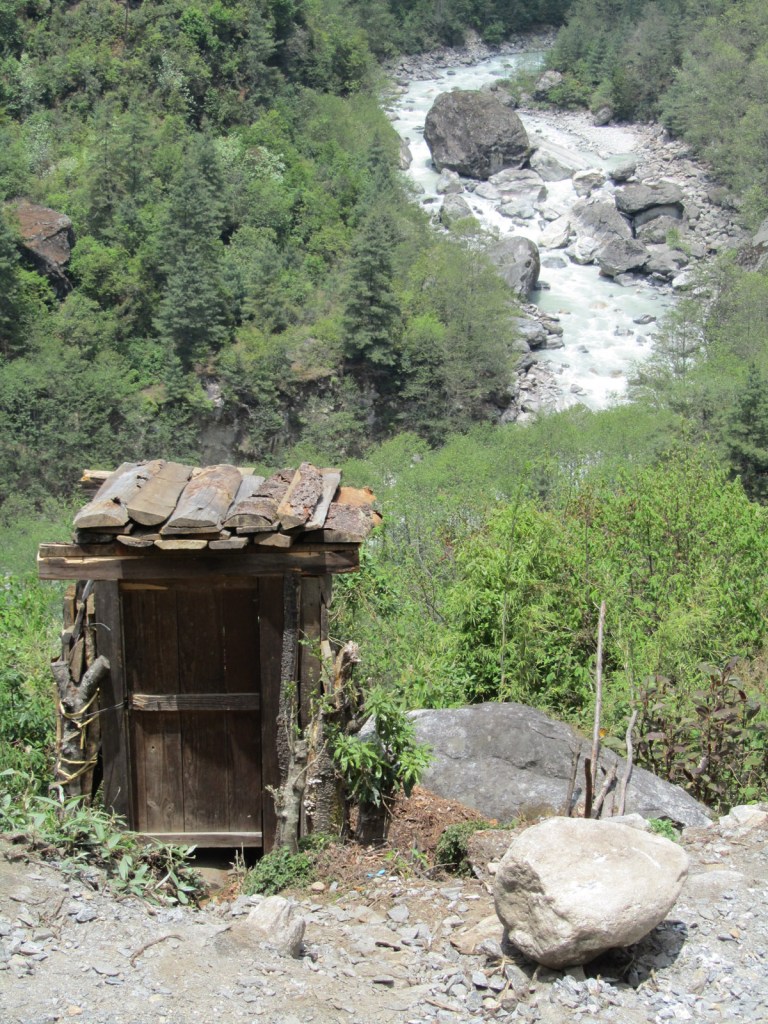
While the facilities weren’t exactly five-star, they were well more than adequate, and who could ask for a better view from the back of one’s outhouse?
Beautiful strong colours of Sagarmatha National Park – after the dust and haze of Dubai it was a delight to be in such a crystal clear environment.

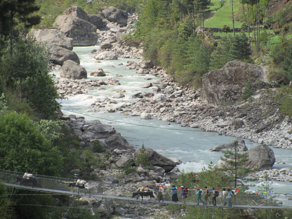
Meltwater from the glaciers and snows of the high peaks charges down the Khumbu valley in icy cold rivers, and the sediment turns the water a milky white. Enormous rocks have been dropped here in the past by receding glaciers.
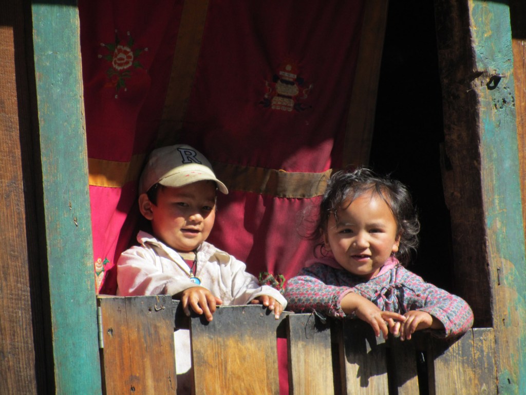
Local Nepalese kids gave us a cheery smile as we trekked past.
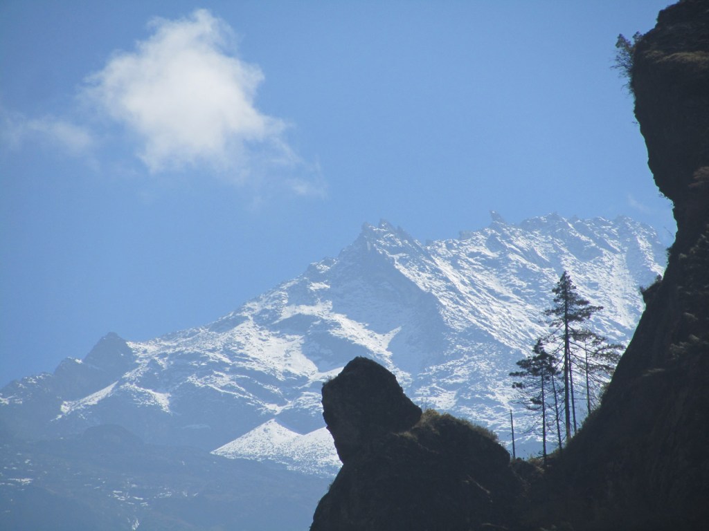
The trek to Namche Bazaar took us past the towering peak of Thamserku, which at 6,608 metres looked pretty big to us, but is still over two kilometres inferior to Mount Everest.
There may be very little in the way of fixed infrastructure in the Khumbu valley, but safe water is produced by boiling with gas burners, supplied by the donkey-driven gas main seen here in full spate. Wood burning for the tourist trade is banned, for preservation of the surrounding forests.

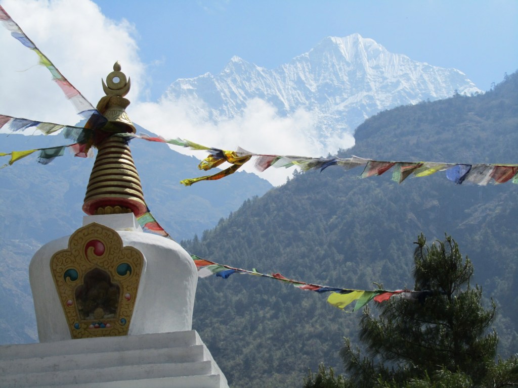
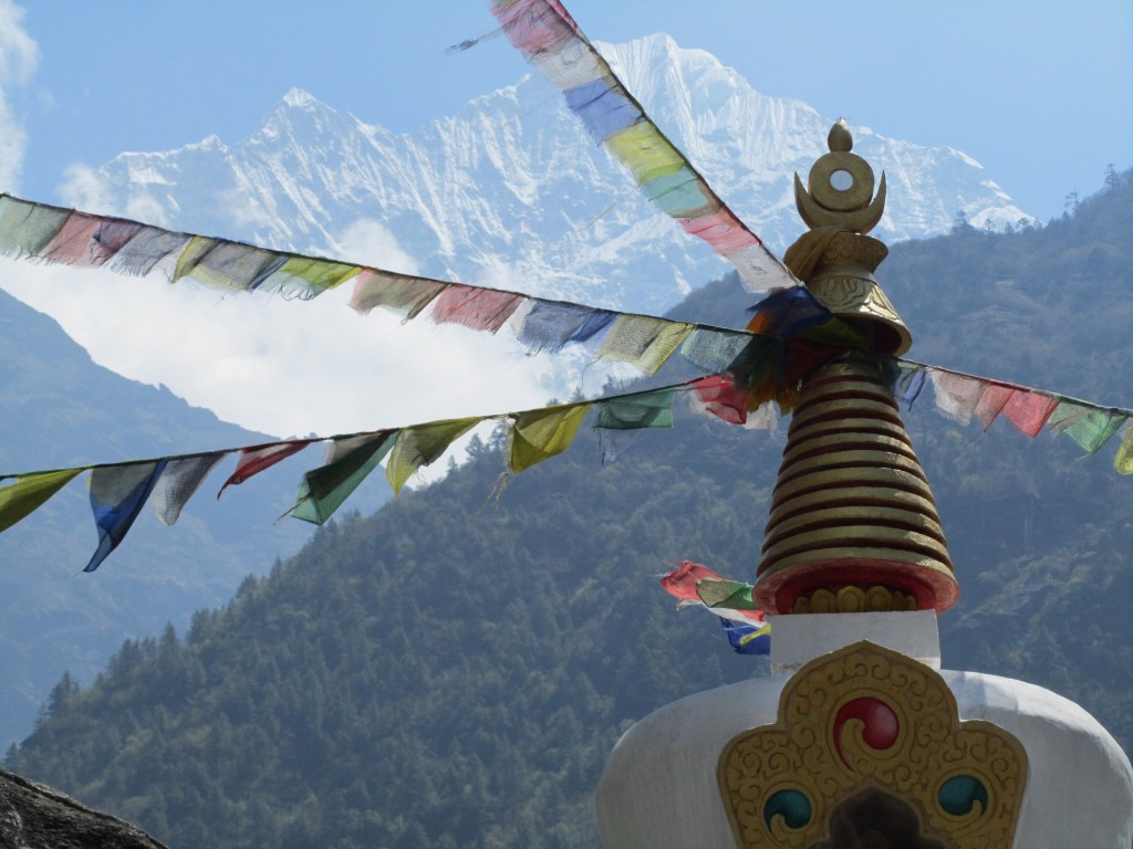
Iconic image of Nepalese prayer flags and a gigantic Himalayan peak behind.
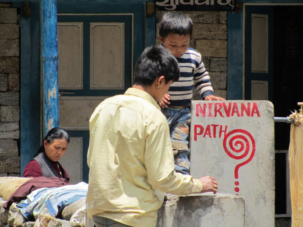
According to this fountain, the path to Namche Bazaar is also the path to Nirvana. I can well believe it.
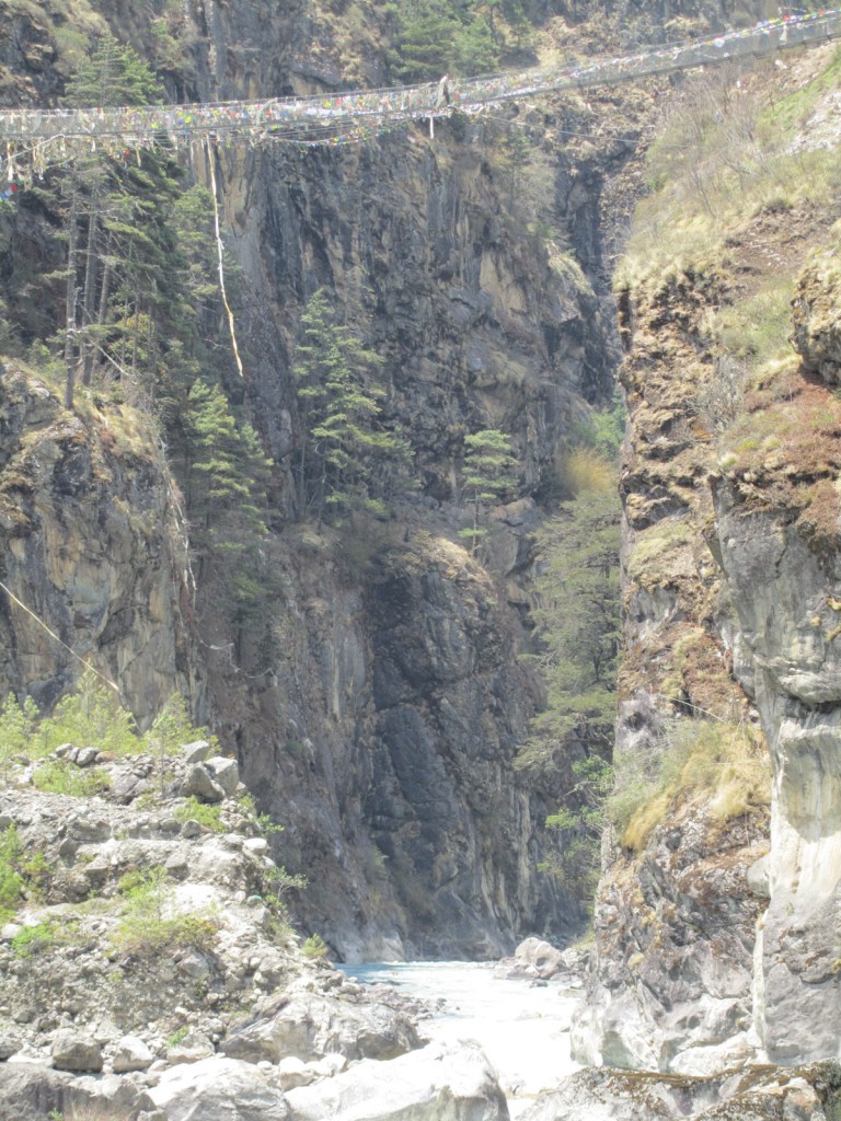
The highest of the many suspension bridges we crossed on the trek up to Namche Bazaar. This is the Hillary bridge hanging high above the Dudhakhosi River. Since my visit, a second bridge has been strung across at an even higher level, with both featuring in the film Everest released in 2015.
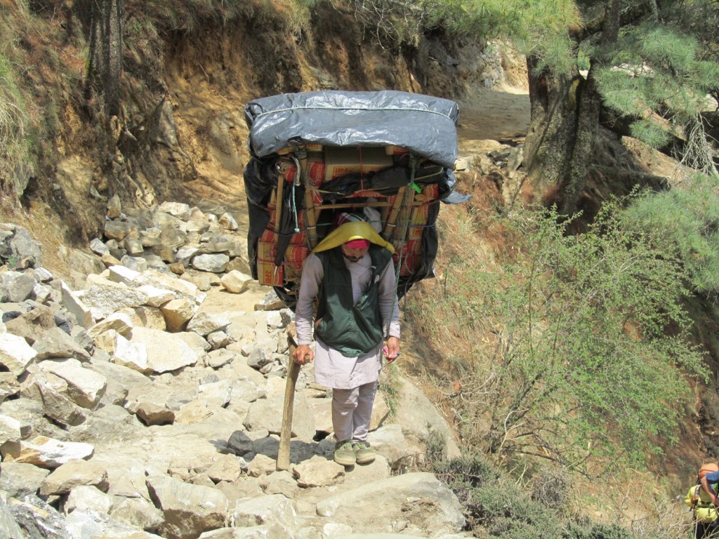
Everything comes up the mountain by muscle power – you can thank this chap for that beer you drank in the mountain bar last night, as he slowly carries nearly one hundred kilos on his back. Porters are paid per unit weight carried, and the faster they can get up and down, the sooner they can score another contract.

Prayer flags fluttering in the blasting wind from the Hillary Bridge. The new, higher bridge presumably avoids the extremely steep steps visible after crossing. We were pretty lucky with the weather, although clouds continued to obscure Mount Everest.
Namche Bazaar, one of the main crossroads of the Khumbu valley and common stopping point for acclimatisation on the way to the peaks. The village is at 3,440 metres elevation, around the same as the lower regions of La Paz. We spent three nights here, I had some very crazy dreams and would occasionally wake up gasping for breath.

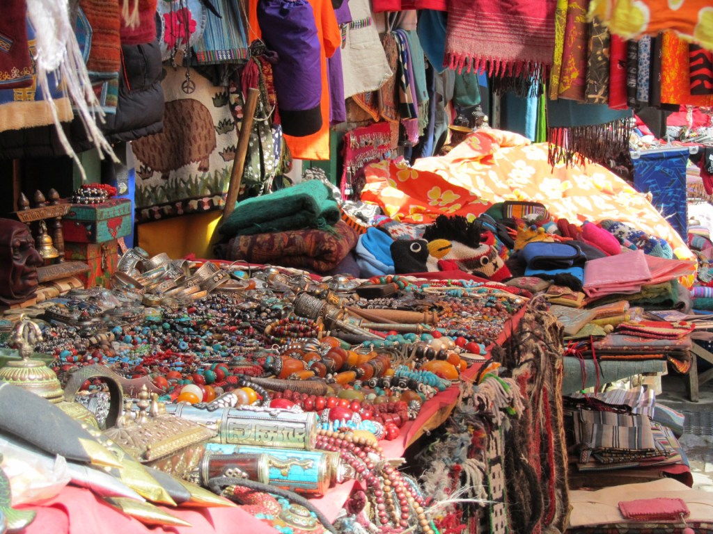
Named not without good reason, Namche Bazaar sells much in the way of clothing and trekking gear in addition to the beads and souvenirs of the bazaar itself. All including the surcharge for somebody to have lugged it up the mountain for your benefit.
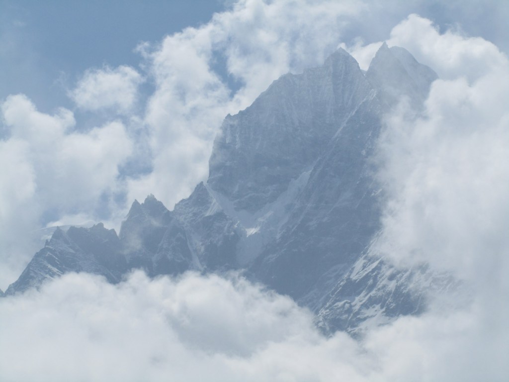
View of another towering Himalayan peak, from the Everest View Hotel at 3,880 metres. Mount Everest herself remained coyly shy and did not reveal herself through the clouds.
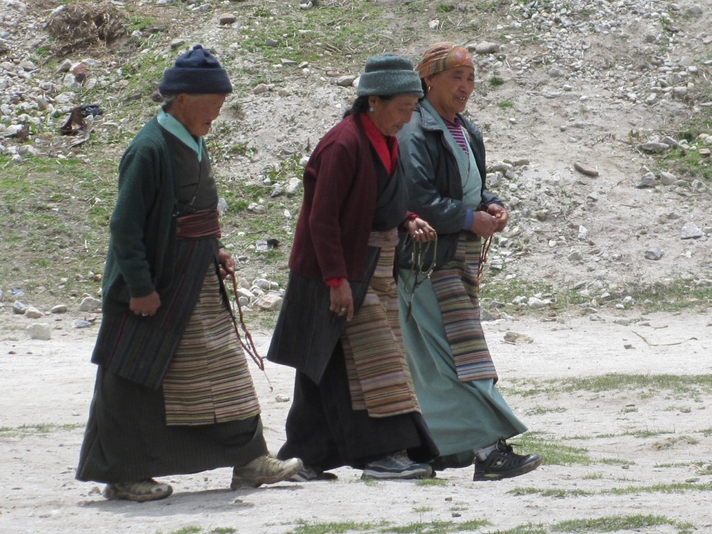
Local ladies out for an afternoon stroll in Khumjung village, above Namche Bazaar.
Khumjung and the neighbouring Khunde villages sit on a shelf up the valley from Namche Bazaar, and were the most distant and highest points on our short trek, at just under 4,000 metres. This monastery is one of the primary draws, with a special artefact inside.
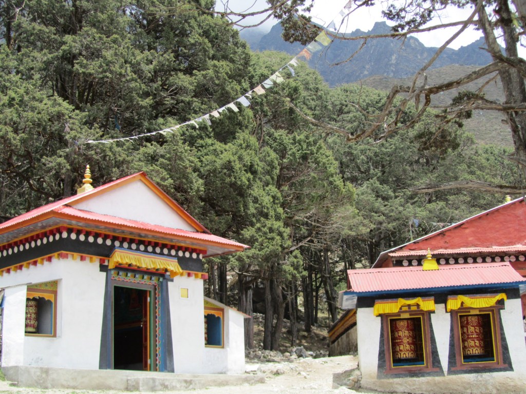
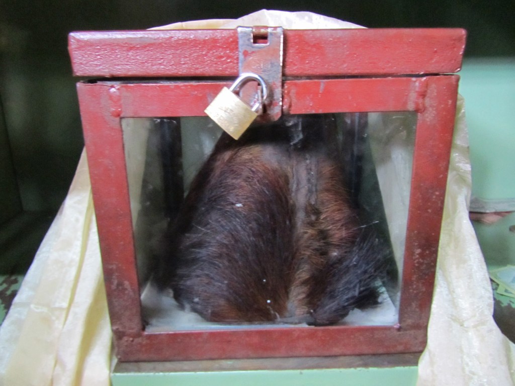
The Yeti scalp of Khumjung Monastery is the only Dalai Lama-approved Yeti scalp in existence. You can see for yourself for a small fee, but it is only put on display for a few moments before being locked away again. What happened to the rest of the Yeti remains a mystery.
Red and gold prayer wheels at Khumjung Monastery – we would always remember to spin them as we walked past.


Another cheerful local in Khumjung village.
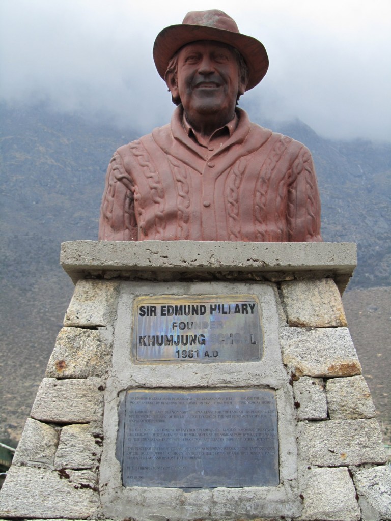
We found Sir Edmund Hillary in truncated effigy at the playground of Khumjung School, one of many which he set up through the Himalayan Trust. Hillary spent much of his life in Nepal after his conquest of Everest with Tenzing Norgay Sherpa, helping to improve the lives of the Sherpas. A true hero.
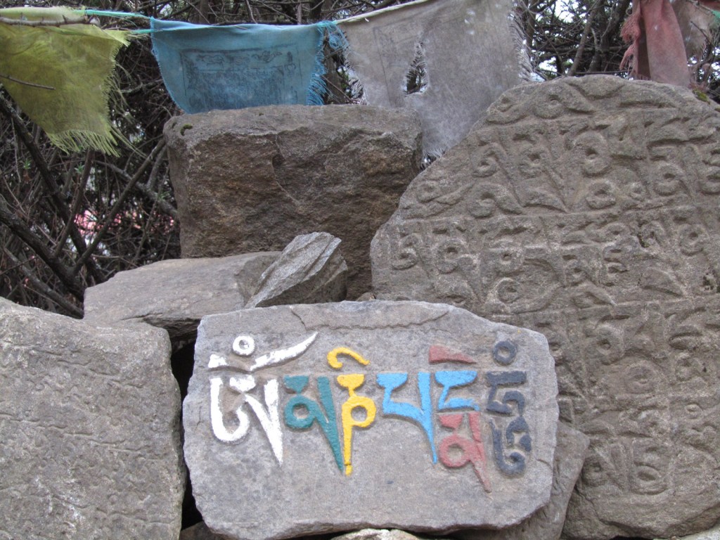
The trail was often flanked by carved stone tablets with Nepali script, occasionally painted as seen here. Similar carvings could be found for sale further down the valley, so naturally I picked one up with same colourful script seen here.
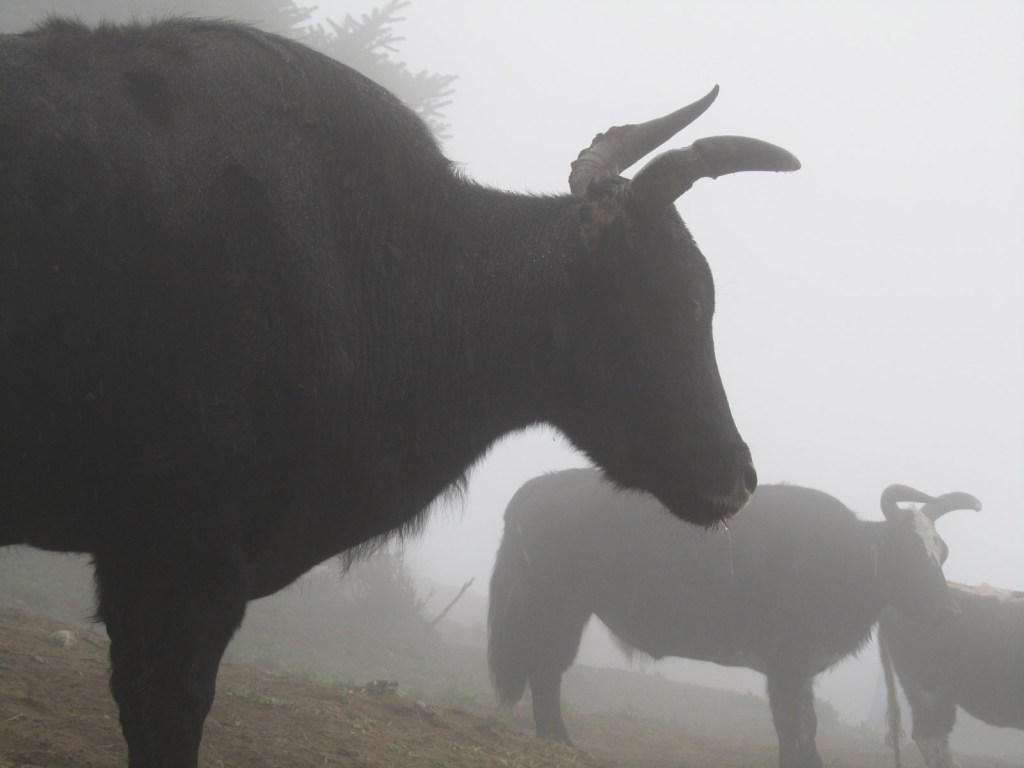
Yaks in the mist above the village of Namche Bazaar. Although I was reliably informed that these are in fact only half-Yaks, being a cross-breed with cows.
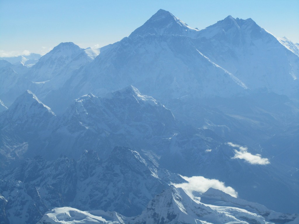
Mount Everest herself, as seen aboard a scenic flight from Kathmandu. During our trek we were unfortunately unable to see the peak due to the unrelenting cloud in its direction, so I took to the air to see the highest point on earth. On the right is Lhotse, the world’s fourth highest peak and up the face of which climbers ascend from the Nepali side.
Created 2013 | Updated 2024

Leave a comment